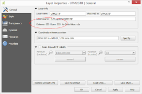
To resample an geo image in QGIS, do the following:
- Start QGIS. Optional. Load in a geo image file to resample.


- Select Raster | Projections | Warp (Reproject).
The Warp (Reproject) dialog box appears.
- In the Input file field, click Select. Browse and select the source file, e.g. UTM2GTIF.tif.
- In the Output file field, click Select. Type in the destination file e.g. ResampleUTM2GTIF.tif.
- Toggle on Resize.
- In the Width field, type in the destination width in pixels e.g. 100.
- In the Height field, type in the destination height in pixels e.g. 133.

- Click OK.
The source file is resampled.


No comments:
Post a Comment