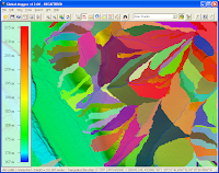
Here are the steps I took to generate the watershed data.
- Start up Global Mapper 12 and load in a digital elevation model as shown below.

- Select File | Generate Watershed.
The Watershed Generation Options dialog box appears.
- Change the X axis and Y axis Resolution if necessary.
- In the Depression Fill Depth field, type in a maximum depth value e.g. 1.

Note: to turn off depression filling, enter 0. - Click OK.
Processing messages appear.

- If you want to generate the watershed basin polygons, then toggle on Create Watershed Areas Showing Drainage to Streams in the Watershed Generation Options dialog box.


Hi to all dominoc925 Readers
ReplyDelete- A complete and official Help ref. to Watershed genarating with GlobalMapper 12.01 - one can find here:
http://www.globalmapper.com.pl/watershed_-_help.html