A common task after an airborne LiDAR data collection is to determine the boundaries of the LiDAR LAS file strips, to visualize where they cover approximately. The screenshot below shows an example of how these LiDAR strips look like, colored by elevation.
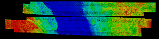 |
| Example of LiDAR data strips |
The boundaries can be generated in various formats using PDAL's
tindex command. Using this command is simple, as shown in the example steps below:
- Open up the OSGeo4W Command Prompt. Change the directory to the folder containing the *.laz files.
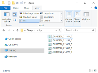 |
| A folder containing LiDAR *.las file strips |
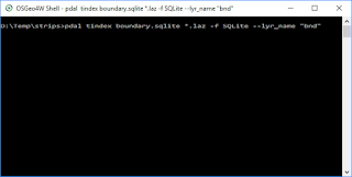
- At the prompt, type in the command:
C:\> pdal tindex boundary.sqlite *.laz -f SQLite --lyr_name "bnd"
where boundary.sqlite is the output file
*.laz specifies the input files using a wildcard
-f SQLite is the output format
--lyr_name "bnd" specifies the layer name to append to the output name
- Press RETURN.
The boundaries are generated.
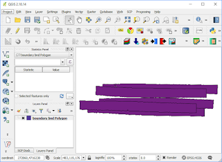
- Optional. After the process is completed, drag and drop the output file e.g. boundary.sqlite onto QGIS.
The LiDAR strips boundary_bnd_polygon are displayed.
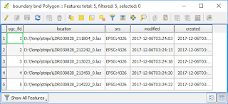
The output boundaries have the following attributes as shown below.