Showing posts with label Street View. Show all posts

Wednesday, June 10, 2015

WebApp for monitoring traffic incidents in Singapore

This web app allows users to monitor traffic incidents in Singapore including accidents, vehicle breakdowns, obstacles, road blocks, traffic diversions etc. in Singapore (updated every 2 minutes) on a Google Maps backdrop by subscribing to the traffic incidents geoRSS feed. The incidents are shown as clickable and color coded icons with tool tips. 


Clicking on the icon will bring up more details about the incident. 

Together with Google's StreetView, users can truly immerse themselves into the incident environment.


The traffic incidents are also shown as a list on the right pane. The list can be sorted by incident category, and date-time - either in ascending or descending order. Clicking the Maps hyperlink will automatically locate, zoom, and center the incident in the Map view.
The WebApp can be launched from this link http://dominoc925-pages.appspot.com/webapp/trafmon_sg/default.html

Monday, May 19, 2014

Trainsity Recife Metro Android App

Find your way around the FIFA World Cup 2014 city of Recife, Brazil using the high resolution vector maps of the MetroRec's Center 1, Center 2, South and Diesel Train Lines. The maps have small file size footprints but with many levels of zoom and can work offline without an Internet connection. Users can tap the train station labels to open Google Maps or Street View, where they can use all the functions of the Google apps to visualize the surrounding area and/or perform routing for directions.

On a mobile handset, the app will display a list of train lines, which when tapped will open up a detail view of the metro transit map, as shown below.

Tapping the station boxes will bring up an option menu where users can choose to display the station in Google Maps or Street View.

The app is also optimized for tablet devices. The layout on a tablet will display both the list and the vector map at the same time, as shown below.

Users can toggle the map to full screen mode by tapping the action bar icon at the top.

The app is available on the Google Play Store. Just click the button below.
Get it on Google Play

Monday, March 17, 2014

Android App for monitoring 911 call incidents in Seattle, Washington

With this Android app, users can monitor the City of Seattle's Fire Department's real time 911 dispatches (which is updated every 5 minutes), the Police Department's 911 Dispatch Incident responses (only non-confidential and updated every 4 hours) and Report Incidents (updated within 6 to 12 hours). The incidents can be viewed as a text list or on a map as marker icons or as a heat map. Examples of incidents include burglary, accident, fire, assault, drugs, death, and many more. Incident details can be viewed by touching an item on the list or a marker icon on the map display. A function is available to easily filter away unwanted incidents from the list or map by text. The app allows the user to send the location  to Google Maps and/or Street View for better visualization of the 911 call incident environment.

Upon launching the app, the list of incidents will be downloaded and displayed with associated icons as shown below.
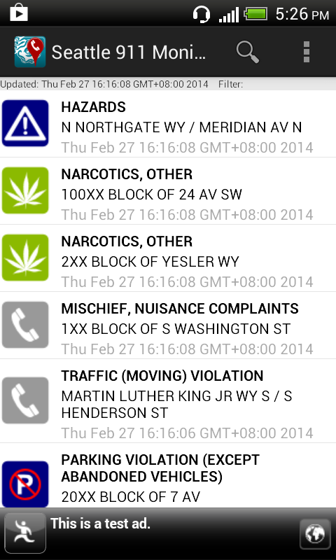
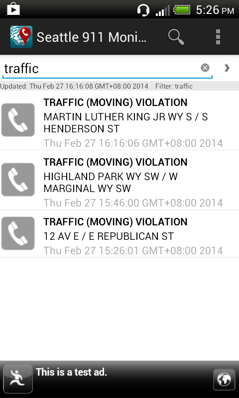
The list of incidents can be filtered by using the Filter command, which is activated by selecting the Filter icon on the Action Bar or menu item. This will toggle the display of the filter text entry field. As you type in any text e.g. traffic, the incident list is dynamically updated.

To view all the incidents on a map, simply select the Map option item in the Action Bar menu. The filter (if any) remains in effect util it is cleared. Touching any incident icon will pop up a snippet of information about the incident. Touching the snippet will display the incident details.
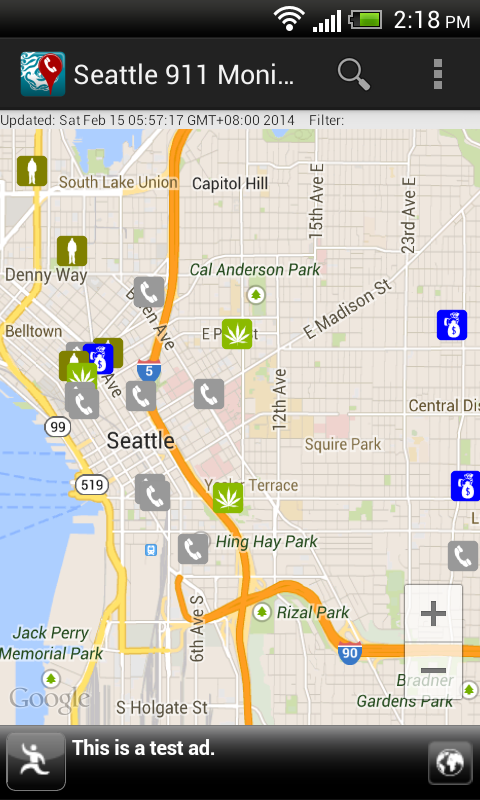
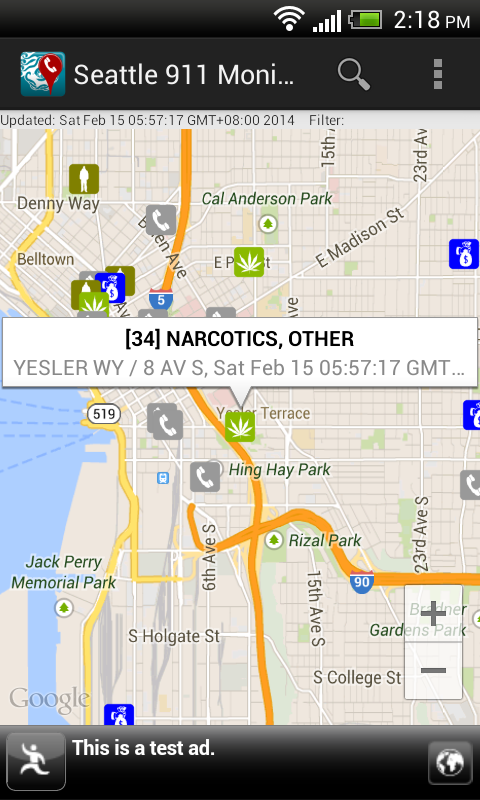
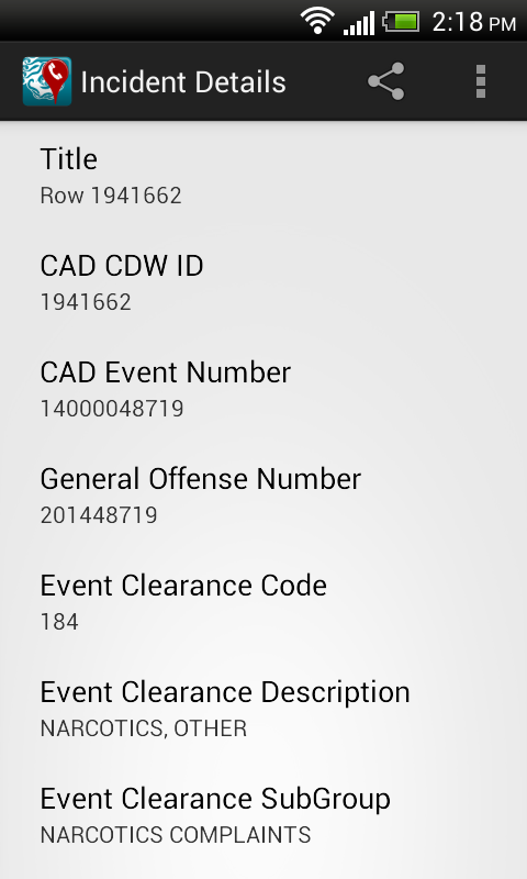
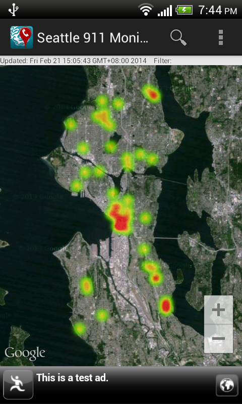
Instead of visualizing the incidents as marker icons, choosing the Heat map option item in the Action Bar menu will render the incidents as a heat map, as shown below. To display as marker icons again, just choose the Markers option item in the Action Bar menu.

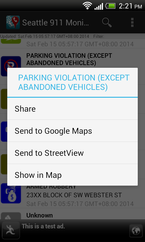
Long pressing any item in the incident list will pop up a menu, as shown below, where the selected incident can be shared, located on a map, or sent to the Google Maps or Street View app.

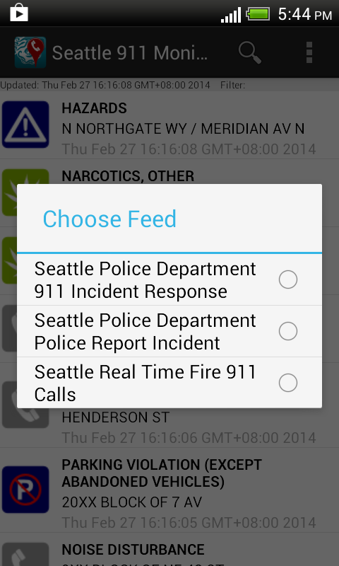
To refresh the call incidents or select a different incident feed, touch the Refresh option item in the Action Bar menu.
 
The app can be downloaded from Google Play.

Get it on Google Play

Monday, December 23, 2013

Seattle 911 incidents monitoring WebApp

This WebApp allows users to monitor the City of Seattle's Fire Department's real time 911 dispatches (updated every five minutes) and the Seattle Police Department's 911 dispatch incident responses that are non-confidential (updated every 4 hours) on a Google Maps backdrop. Simply choose the appropriate feed on the 911 feed drop down menu on the right pane.


The 911 incidents are shown as clickable icons with tool tips on Google Maps. Clicking on an icon will bring up more details about the incident. Users can utilize additional built-in Google Maps features such as Street View, or 3-D oblique 45 degrees views to immerse themselves into the incident environment.


The 911 incidents are also shown as a list on the right pane. The list can be sorted by incident category, date-time and address - either in ascending or descending order. Clicking the Maps hyperlink will automatically locate, zoom, and center the incident in the Map view.

The WebApp can be launched from this link http://dominoc925-pages.appspot.com/webapp/seattle911mon/default.html

Monday, October 28, 2013

Trainsity Bangkok Android App

Find your way around the city of Bangkok using the high resolution vector maps of the Bangkok Sky Train ( BTS), Metro (MRT) and Airport Rail Link train network. The maps have small file size footprints but with many levels of zoom and can work offline without connecting to the Internet. Users can click the train station labels to open Google Maps or Google Street View, where they can use all the functions of the Google apps to visualize the surrounding area and/or perform routing for directions.


On a mobile handset, the app will display a list of train maps, which when tapped will open up a detail view of the transit map, as shown below.

Tapping the station boxes will bring up an option menu where users can choose to display the station either in Google Maps or Street View.


On a tablet sized device, the app will display both the list and the detail map view, as shown below.

  If desired, the user can toggle the map to full screen mode by tapping the action bar icon.
The app can be downloaded from the Google Play Store.
Get it on Google Play

Monday, September 16, 2013

Trainsity Singapore Android app

This is an Android app that simply displays the Singapore MRT and LRT train network maps. The maps are high resolution vector files instead of raster images; the file sizes are small and you can zoom closer without having the details becoming blurred or "pixelated", like bitmap images. The maps also have some interactivity coded in - when the train station labels are touched (or clicked), an option menu will pop up. Users can then choose to send the station location to the Google Maps or the Google Street View apps, where they can visualize the surroundings and/or perform directions routing.


The following screenshots show how the app behaves on a mobile handset.


On tablets, the app will automatically configure itself as a two pane display, as shown below. An ActionBar toggle button can be used to toggle the map display from two pane to full screen.


The app can be download from the Google Play Store.
Get it on Google Play

Monday, August 12, 2013

Android App for monitoring 911 incidents in the City of Portland, Oregon


Users can monitor the City of Portland, Oregon's Police 911 Dispatch Incidents using this made for Android app - Portland 911 Incidents Monitor. The 100 most recent, closed, non-confidential calls for service received by the City of Portland's 911 system can be viewed as a text list or on a map as icons. Incident details can be viewed by touching an item on the list or a marker on the map display. A function is available to easily filter away unwanted incidents from the list or map by text. The app allows the user to send the incident location to Google Maps and/or Street View for better visualization of the 911 incident environment.
Upon launching the app, the list of incidents will be downloaded and displayed with associated icons as shown below.

The list of incidents can be filtered by using the Filter command - activated by selecting the Filter icon on the Action Bar or menu item. This will toggle the display of the filter text entry field. As you type in any text e.g. traffic, the incident list is dynamically updated.

To view all the incidents on a map, simply select the Map option item in the Action Bar menu. The filter (if any) remains in effect until it is cleared. Touching any incident icon will pop up a snippet of information about the incident. Touching the snippet will display the incident details.


Long pressing any item in the incident list will pop up a menu, as shown below, where the selected incident can be shared, located on a map, or send to the Google Maps app.


Using the Google Maps app, Street View can be activated for better visualization of the incident environment.


Android app on Google Play