Showing posts with label Google Maps. Show all posts

Friday, March 13, 2026

Quakemon - Monitor Earthquakes Android App


Monitor earthquakes, volcano eruptions across countries with Quakemon.


Stay informed with up-to-date incidents and live camera views, all presented through an intuitive map and list interface designed for quick situational awareness.

Key Features:

1. Multi-Countries Earthquakes Monitoring
View earthquake incidents across supported countries using an interactive map or a clear, scrollable list.

2. Detailed Incident Information
Tap any incident in the list or on the map to view detailed information, including location and incident magnitude.

3. Live Volcano Cameras
Tap a camera marker to instantly view a live, zoomable volcano image for real-time conditions.

4. Powerful Filtering
Filter incidents by tags to hide unwanted information and focus only on what matters to you.

5. Camera Favorites
Save frequently used cameras to a favourites list and reorder them for quick and easy access.

Quakemon makes it easy to monitor earthquake events efficiently and stay informed.

Data Sources

Earthquakes and environmental data used in this app may be provided by:

1. Earth Sciences New Zealand (https://earthscience.nz)
2. Geoscience Australia (https://earthquakes.ga.gov.au)
3. GEOFON program of the GFZ Helmholtz Centre for Geosciences Germany(https://geofon.gfz.de)
4. Institute of Geodynamics - National Observatory of Athens (NOA-IG) Greece (https://bbnet.gein.noa.gr)
5. Istituto Nazionale di Geofisica e Vulcanologia Italy (https://terremoti.ingv.it)
6. Kandilli Observatory and Earthquake Research Institute (KOERI) and Regional Earthquake-Tsunami Monitoring Center (RETMC) Turkey (http://www.koeri.boun.edu.tr)
7. BMKG (Badan Meteorologi, Klimatologi, dan Geofisika) Indonesia (https://data.bmkg.go.id)
8. Natural Resources Canada (https://www.earthquakescanada.nrcan.gc.ca)
9. British Geological Survey (UK) (https://earthquakes.bgs.ac.uk)
10. European-Mediterranean Seismological Centre (EMSC) (https://www.emsc-csem.org)
11. USGS (https://www.usgs.gov)

 Download and try out the Quakemon app from the Google Play Store:

Get it on Google Play 

Monday, November 11, 2019

Android Studio: Automatically replace the Google Maps V2 API Key for debug and release mode

The Android Google Maps API requires a separate debug and release keys in the Android Studio project's AndroidManifest.xml file, as shown in the listing below.

<meta-data
android:name="com.google.android.maps.v2.API_KEY"
android:value="your_google_maps_v2_api_debug_or_release_key_here" />
It can get tedious having to replace the key every time you want to debug or to generate a release build APK.

It is possible to use Gradle to automate the replacement of the Google Maps V2 API key value by using constants defined in the Gradle build types. To automate the replacement, you can do the following:
  1. In the Android app's build.gradle file, add in the following line under the debug component of buildTypes:

    resValue "string", "google_maps_v2_api_key", "your_google_maps_v2_debug_api_key_here"

    Note: replace the api key accordingly; and the constant name is google_maps_v2_api_key.
  2. Similarly, add in the following line under the release component of buildTypes:

    resValue "string", "google_maps_v2_api_key", "your_google_maps_v2_release_api_key_here"
  3. The Android app's build.gradle should look like this screenshot below:


  4. Now, in the app's AndroidManifest.xml file, replace the Google Maps V2 API key metadata value to the string constant name google_maps_v2_api_key.

    <meta-data
    android:name="com.google.android.maps.v2.API_KEY"
    android:value="@string/google_maps_v2_api_key" />
    

Now you can debug or build the Android app as per normal without manually replacing the Google Maps V2 API key.

Monday, January 29, 2018

Display CSV (with WKT geometry field) files on Google Maps with this Mapplet

If you want to display a Comma Separated Values (CSV) file with an embedded geometry field in Well Known Text (WKT) format with just an Internet browser, then this Mapplet may be useful to you. Just go to this url https://dominoc925-pages.appspot.com/mapplets/vcsvfile.html with any modern browser such as Chrome, or FireFox. All the processing is done within your browser, that is the CSV file is never uploaded to a server for processing.


  1. To load a CSV file, click on the Import CSV button (in blue color) as shown in the screenshot below. 


    The Import Comma Separated Values (CSV) file dialog box appears.

  2. To load in a CSV file from a local drive, click the Choose File button. Then browse and select a CSV file as shown below.


    Note: You can also copy and paste WKT text into the CSV file field's text area. Or click the Use Sample Data drop up button to load demo WKT data into the text area.

  3. Click Open.

    The file is read and displayed in the text area below the Choose File button. The WKT Geometry column button is populated with the header fields from the CSV file.


    Note: If necessary, choose an appropriate Coordinate System and projection.
  4. Click Start Import.

    The CSV file is loaded and rendered as overlays on the Google Maps backdrop. The name of the file is added to a CSV files combo box.

  5. Optional. Click on the CSV Command drop up button and choose a command to apply to the current CSV layer.


    Fit - Display the current CSV layer within the map
    Fit All - Display all loaded CSV layers within the map
    Toggle display - Toggle the CSV layer display on or off
    Display off - Don't display the current CSV layer
    Display on - Display the current CSV layer
    Remove layer - Unload the current CSV layer

Monday, August 7, 2017

Android Studio Emulator: How I resolved a Google Maps SupportMapFragment GLThread exception

While attempting to open up a Google Maps SupportMapFragment in the Android Studio Emulator, the Activity crashed with the following error messages:

[ 08-07 00:50:44.423  3266: 3523 W/         ]
                                                                     Unrecognized GLES max version string in extensions: ANDROID_EMU_CHECKSUM_HELPER_v1 ANDROID_EMU_dma_v1 
08-07 00:50:44.429 3266-3523/com.dom925.volcamr.nz E/EGL_emulation: rcCreateContext returned 0
08-07 00:50:44.429 3266-3523/com.dom925.volcamr.nz E/EGL_emulation: tid 3523: eglCreateContext(1434): error 0x3003 (EGL_BAD_ALLOC)
                                                                    
                                                                    --------- beginning of crash
08-07 00:50:44.429 3266-3523/com.dom925.volcamr.nz E/AndroidRuntime: FATAL EXCEPTION: GLThread 276
                                                                     Process: com.dom925.volcamr.nz, PID: 3266
                                                                     java.lang.RuntimeException: createContext failed: 12291
                                                                         at com.google.maps.api.android.lib6.gmm6.vector.az.a(:com.google.android.gms.DynamiteModulesB:29)
                                                                         at com.google.maps.api.android.lib6.gmm6.vector.ba.f(:com.google.android.gms.DynamiteModulesB:158)
                                                                         at com.google.maps.api.android.lib6.gmm6.vector.ba.run(:com.google.android.gms.DynamiteModulesB:11)

The same Android app has no issue running on a real handset.

After some fiddling around with the emulator settings, the problem was resolved by changing the emulator's graphics emulated performance from automatic to either Hardware GLES 2.0 or Software GLES 2.0 as shown below.

Monday, February 13, 2017

Show Myanmar Datum 2000 coordinates with this Mapplet

Myanmar uses a Universe Transverse Mercator projection at Zone 46 (with a Myanmar Datum 2000). For convenience, this mapplet has been written to display and locate Myanmar easting, northing coordinates on Google Maps. To show the coordinates of a location on the map, just click a point on the map, as shown in the screenshot below. A marker Info window will pop up displaying the Myanmar Datum 2000 easting and northing coordinates, as well as the Geographic latitude, and longitude values.

Try out this mapplet at this location https://dominoc925-pages.appspot.com/mapplets/cs_myanmar2000.html

Monday, August 22, 2016

WebApp for viewing City of Tulsa, Oklahoma's Fire Department's dispatches

Users can make use of this WebApp to monitor the City of Tulsa, Oklahoma's Fire Department fire dispatch data (updated every minute) on a Google Maps backdrop. The incidents are shown as clickable icons with tool tips on Google Maps. Clicking an icon will bring up more details about the incident.

Users can utilise additional built-in Google Maps features such as Street View to immerse themselves into the environment of the incident.

The pane on the right can display a list of the fire incidents. The list can be sorted by category, date-time and address - either in ascending or descending order. Clicking the Maps hyperlink will automatically locate, zoom and center the incident in the Map View.

The WebApp can be launched from this link https://dominoc925-pages.appspot.com/webapp/tulsa911mon/.

Monday, July 11, 2016

Google Mapplet for displaying Earth Centered, Earth Fixed (ECEF) coordinates

The ECEF (Earth-Centered, Earth-Fixed) coordinate system is commonly used when working with satellites, GPS, space mechanics. For more information, see the Wikipedia site at https://en.wikipedia.org/wiki/ECEF. Sometimes, it may be necessary to convert between ECEF coordinates to geodetic latitude, longitude and altitude coordinates.

This Google Mapplet Show ECEF Coordinates is an easy to use tool for displaying ECEF coordinates on a Google Maps background. To show the coordinates of a location on the map, just click a point on the map, as shown in the screenshot below.

Alternatively, given an ECEF coordinate, simply type in the ECEF's XYZ coordinates in the right pane and click the Locate button. The point will be centered and marked in the map display, as shown below.

Try on this tool at this location https://dominoc925-pages.appspot.com/mapplets/cs_ecef.html


Monday, February 15, 2016

District of Columbia crime incidents and service calls requests monitoring WebApp

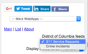
This WebApp allows users to monitor the District of Columbia's 311 service request calls and crime incidents on a Google Maps backdrop. To use the WebApp, simply choose the appropriate feed on the District of Columbia feeds drop down menu on the right pane, as shown below.


The incidents are shown as clickable icons with tool tips on Google Maps. Clicking on an icon will bring up more details about the incident. 

Users can utilize additional built-in Google Maps features such as Street View,  to immerse themselves into the incident environment.


The incidents are also shown as a list on the right pane. The list can be sorted by incident category, date-time, and address - either in ascending or descending order. Clicking the Maps hyperlink will automatically locate, zoom, and center the incident in the Map view.

The WebApp can be launched from this link https://dominoc925-pages.appspot.com/webapp/dc911mon/


Monday, January 18, 2016

Columbia, Missouri 911 incidents monitoring WebApp

This WebApp allows users to monitor the City of Columbia, Missouri's real time 911 fire and rescue dispatch incidents on a Google Maps backdrop.

The 911 incidents are shown as clickable icons with tool tips on Google Maps. Clicking on an icon will bring up more details about the incident. Users can utilise additional built-in Google Maps feature such as Street View to immerse themselves in the incident's environment.


The 911 incidents are also shown as a list in the right pane. The list can be sorted by incident category, date-time and address - either in ascending or descending order. Clicking the Maps hyperlink will automatically locate, zoom, and center the incident in the Map View.

The WebApp can be launched from this link https://dominoc925-pages.appspot.com/webapp/columbiamo911mon/

Wednesday, June 10, 2015

WebApp for monitoring traffic incidents in Singapore

This web app allows users to monitor traffic incidents in Singapore including accidents, vehicle breakdowns, obstacles, road blocks, traffic diversions etc. in Singapore (updated every 2 minutes) on a Google Maps backdrop by subscribing to the traffic incidents geoRSS feed. The incidents are shown as clickable and color coded icons with tool tips. 


Clicking on the icon will bring up more details about the incident. 

Together with Google's StreetView, users can truly immerse themselves into the incident environment.


The traffic incidents are also shown as a list on the right pane. The list can be sorted by incident category, and date-time - either in ascending or descending order. Clicking the Maps hyperlink will automatically locate, zoom, and center the incident in the Map view.
The WebApp can be launched from this link http://dominoc925-pages.appspot.com/webapp/trafmon_sg/default.html

Monday, May 19, 2014

Trainsity Recife Metro Android App

Find your way around the FIFA World Cup 2014 city of Recife, Brazil using the high resolution vector maps of the MetroRec's Center 1, Center 2, South and Diesel Train Lines. The maps have small file size footprints but with many levels of zoom and can work offline without an Internet connection. Users can tap the train station labels to open Google Maps or Street View, where they can use all the functions of the Google apps to visualize the surrounding area and/or perform routing for directions.

On a mobile handset, the app will display a list of train lines, which when tapped will open up a detail view of the metro transit map, as shown below.

Tapping the station boxes will bring up an option menu where users can choose to display the station in Google Maps or Street View.

The app is also optimized for tablet devices. The layout on a tablet will display both the list and the vector map at the same time, as shown below.

Users can toggle the map to full screen mode by tapping the action bar icon at the top.

The app is available on the Google Play Store. Just click the button below.
Get it on Google Play

Monday, March 17, 2014

Android App for monitoring 911 call incidents in Seattle, Washington

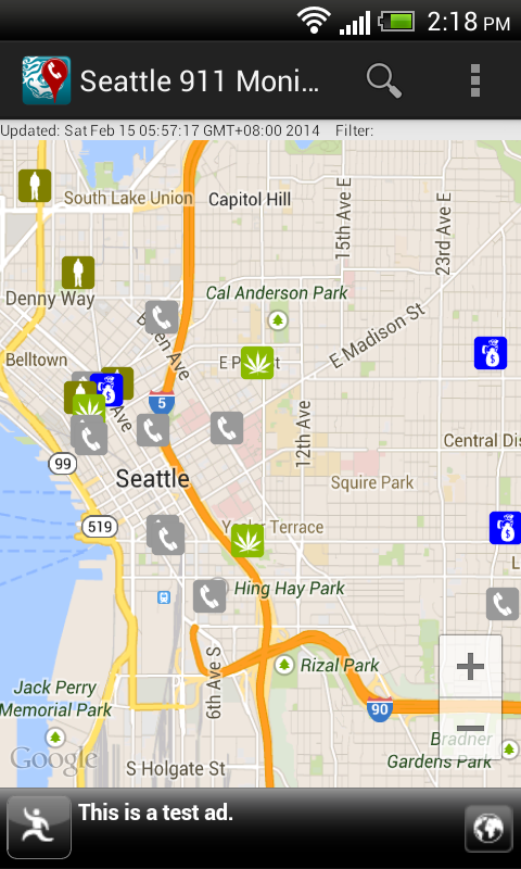
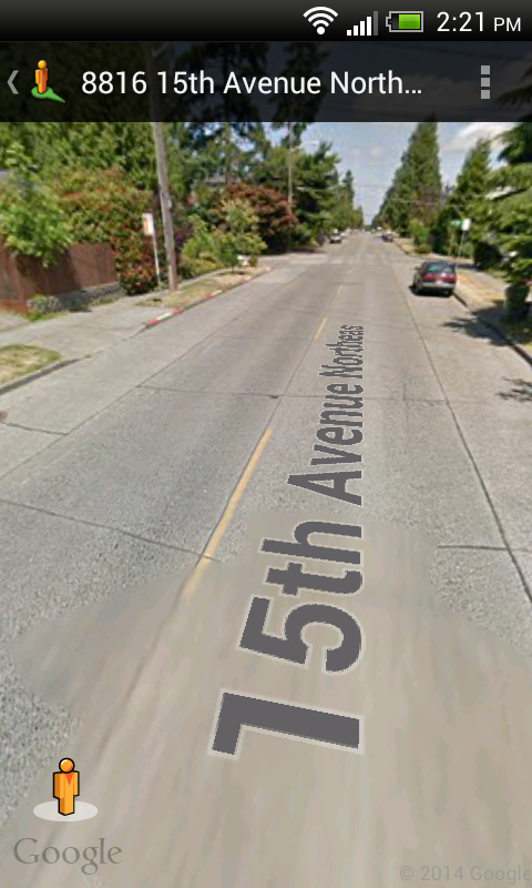
With this Android app, users can monitor the City of Seattle's Fire Department's real time 911 dispatches (which is updated every 5 minutes), the Police Department's 911 Dispatch Incident responses (only non-confidential and updated every 4 hours) and Report Incidents (updated within 6 to 12 hours). The incidents can be viewed as a text list or on a map as marker icons or as a heat map. Examples of incidents include burglary, accident, fire, assault, drugs, death, and many more. Incident details can be viewed by touching an item on the list or a marker icon on the map display. A function is available to easily filter away unwanted incidents from the list or map by text. The app allows the user to send the location  to Google Maps and/or Street View for better visualization of the 911 call incident environment.

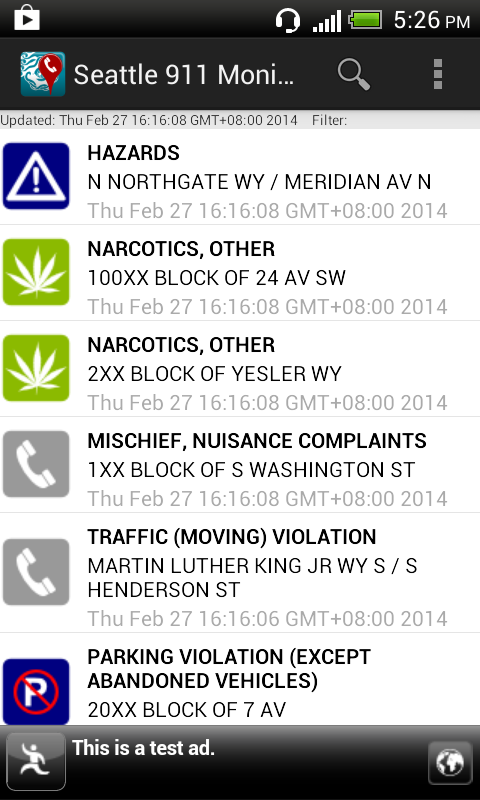
Upon launching the app, the list of incidents will be downloaded and displayed with associated icons as shown below.

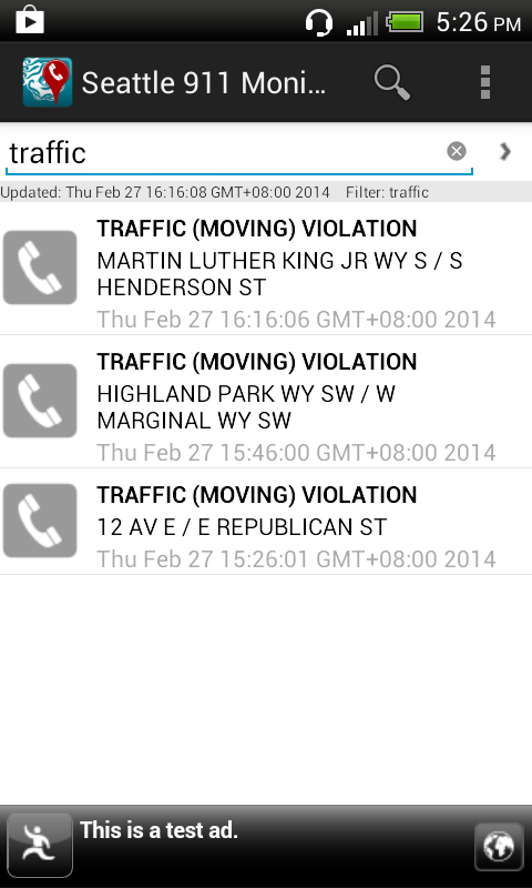
The list of incidents can be filtered by using the Filter command, which is activated by selecting the Filter icon on the Action Bar or menu item. This will toggle the display of the filter text entry field. As you type in any text e.g. traffic, the incident list is dynamically updated.


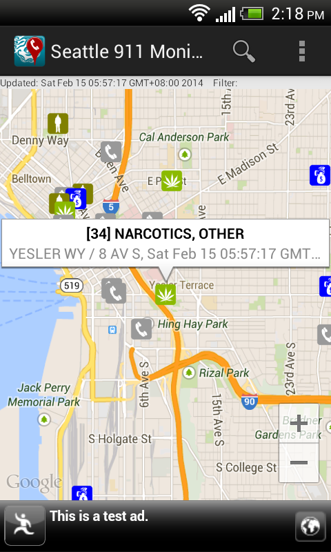
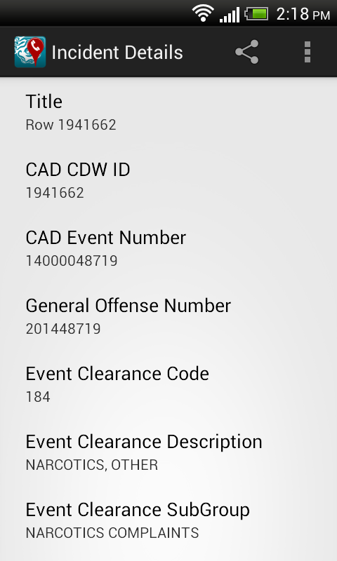
To view all the incidents on a map, simply select the Map option item in the Action Bar menu. The filter (if any) remains in effect util it is cleared. Touching any incident icon will pop up a snippet of information about the incident. Touching the snippet will display the incident details.


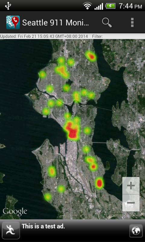
Instead of visualizing the incidents as marker icons, choosing the Heat map option item in the Action Bar menu will render the incidents as a heat map, as shown below. To display as marker icons again, just choose the Markers option item in the Action Bar menu.


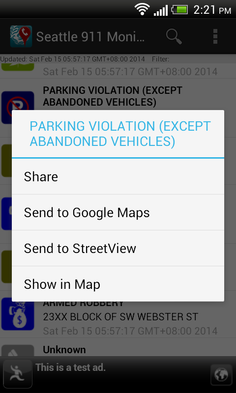
Long pressing any item in the incident list will pop up a menu, as shown below, where the selected incident can be shared, located on a map, or sent to the Google Maps or Street View app.


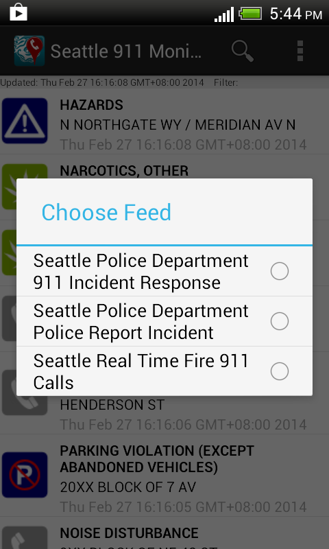
To refresh the call incidents or select a different incident feed, touch the Refresh option item in the Action Bar menu.
 
The app can be downloaded from Google Play.
Get it on Google Play