Showing posts with label Public Safety. Show all posts

Monday, August 22, 2016

WebApp for viewing City of Tulsa, Oklahoma's Fire Department's dispatches

Users can make use of this WebApp to monitor the City of Tulsa, Oklahoma's Fire Department fire dispatch data (updated every minute) on a Google Maps backdrop. The incidents are shown as clickable icons with tool tips on Google Maps. Clicking an icon will bring up more details about the incident.

Users can utilise additional built-in Google Maps features such as Street View to immerse themselves into the environment of the incident.

The pane on the right can display a list of the fire incidents. The list can be sorted by category, date-time and address - either in ascending or descending order. Clicking the Maps hyperlink will automatically locate, zoom and center the incident in the Map View.

The WebApp can be launched from this link https://dominoc925-pages.appspot.com/webapp/tulsa911mon/.

Monday, May 23, 2016

Android App for monitoring Washington, DC crime incidents and 311 service requests

This is an Android app for monitoring Washington DC's 311 service request calls and crime incidents. The incidents can be viewed as a text list or as icons or heatmap on a map. Details about the calls can be viewed by tapping an item on the list or on a marker on the map display. A function is available to easily filter away unwanted incidents from the list or map by a text search. The app allows the user to send the incident location to the external Google Maps and/or Street View for better visualization of the incident environment.

Upon launching the app, the list of incidents can be downloaded and displayed with categorized icons, as shown below.

To view all the incidents on a map, simply select the Map option item in the Toolbar menu. Tapping any icon will pop up a snippet of information about the incident. Tapping the snippet will display the incident details.

Long pressing any list item or tapping the arrow icon will pop up a menu, as shown below, where the selected incident can be shared, located on a map, or sent to the Google Maps or Street View apps.

Users can visualise the incidents as a heat map instead of as marker icons. This can be done by choosing toggling the Heat map menu option on in the Tool bar menu, as shown below. To display as marker icons again, just toggle off the Heat map option.

On a table, the app will display a two pane layout - a list on the left and a map view on the right, as shown below.

As on a handset, the incidents can be displayed as marker icons or as a heat map.


Click the badge below to download the app from the Google Play Store.
Get it on Google Play

Monday, February 15, 2016

District of Columbia crime incidents and service calls requests monitoring WebApp

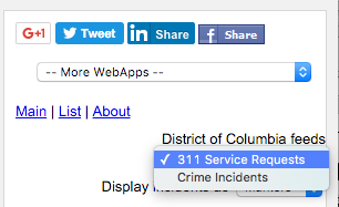
This WebApp allows users to monitor the District of Columbia's 311 service request calls and crime incidents on a Google Maps backdrop. To use the WebApp, simply choose the appropriate feed on the District of Columbia feeds drop down menu on the right pane, as shown below.


The incidents are shown as clickable icons with tool tips on Google Maps. Clicking on an icon will bring up more details about the incident. 

Users can utilize additional built-in Google Maps features such as Street View,  to immerse themselves into the incident environment.


The incidents are also shown as a list on the right pane. The list can be sorted by incident category, date-time, and address - either in ascending or descending order. Clicking the Maps hyperlink will automatically locate, zoom, and center the incident in the Map view.

The WebApp can be launched from this link https://dominoc925-pages.appspot.com/webapp/dc911mon/


Monday, January 18, 2016

Columbia, Missouri 911 incidents monitoring WebApp

This WebApp allows users to monitor the City of Columbia, Missouri's real time 911 fire and rescue dispatch incidents on a Google Maps backdrop.

The 911 incidents are shown as clickable icons with tool tips on Google Maps. Clicking on an icon will bring up more details about the incident. Users can utilise additional built-in Google Maps feature such as Street View to immerse themselves in the incident's environment.


The 911 incidents are also shown as a list in the right pane. The list can be sorted by incident category, date-time and address - either in ascending or descending order. Clicking the Maps hyperlink will automatically locate, zoom, and center the incident in the Map View.

The WebApp can be launched from this link https://dominoc925-pages.appspot.com/webapp/columbiamo911mon/

Monday, September 15, 2014

Android App for monitoring 911 incident calls in Tampa Bay, Florida


Users can monitor Tampa City's Fire Dept.'s call for services (updated every 10 minutes), the Police Department's calls for service (updated within 30 to 45 minutes), and traffic related calls for service (updated every 15 minutes); and Pinellas County's fire call for services. The incidents can be viewed as a text list or on a map as icons or as a heat map. Examples of incidents include burglary, accident, fire, assault, drugs, death, and many more. Incident details can be viewed by touching an item on the list or a marker on the map display. A function is available to easily filter away unwanted incidents from the list or map by text. The app allows the user to send the incident location to Google Maps and/or Street View for better visualization of the 911 incident environment.

Upon launching the app on a handset, the list of incidents will be downloaded (if not downloaded before) and displayed with associated icons as shown below. Subsequently, the user will have to explicitly tap the Refresh icon and choose a feed to download again. 
The list of incidents can be filtered by using the Filter command, which is activated by selecting the Filter icon on the Action bar or menu item. This will toggle the display of the filter text entry field. As you type in any text, e.g. medical, the incident list is dynamically updated. 
To view all the incidents on a map, just tap the Map option item in the Action Bar menu. The filter (if any) remains in effect until it is cleared. Touching any incident icon will pop up a snippet of information about the incident. Touching the snippet will display the incident details.
Users can visualize the incidents a heat map instead of as marker icons. This can be done by choosing the Heat map option item in the Action Bar menu, as shown below. To display as marker icons again, just choose the Markers option item in the Action Bar menu. 
Long pressing any item in the incident list will pop up a menu, as shown below, where the selected incident can be shared, located on a map, or sent to the Google Maps or Street View apps. 

On a tablet, the app will display a two pane layout - an incident list on the left, and a map view on the right, as shown below. 

As on a handset, the incidents can be displayed as marker icons or as a heat map. 
Long pressing an item on the list will pop up a menu.

To refresh the incident list, tap the Refresh icon and choose a feed to download. 

You can download this app on the Play Store.

Get it on Google Play

Monday, March 17, 2014

Android App for monitoring 911 call incidents in Seattle, Washington

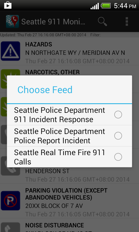
With this Android app, users can monitor the City of Seattle's Fire Department's real time 911 dispatches (which is updated every 5 minutes), the Police Department's 911 Dispatch Incident responses (only non-confidential and updated every 4 hours) and Report Incidents (updated within 6 to 12 hours). The incidents can be viewed as a text list or on a map as marker icons or as a heat map. Examples of incidents include burglary, accident, fire, assault, drugs, death, and many more. Incident details can be viewed by touching an item on the list or a marker icon on the map display. A function is available to easily filter away unwanted incidents from the list or map by text. The app allows the user to send the location  to Google Maps and/or Street View for better visualization of the 911 call incident environment.

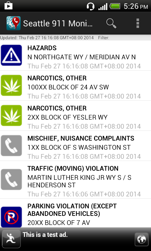
Upon launching the app, the list of incidents will be downloaded and displayed with associated icons as shown below.

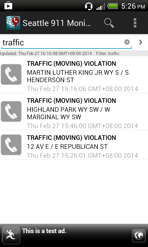
The list of incidents can be filtered by using the Filter command, which is activated by selecting the Filter icon on the Action Bar or menu item. This will toggle the display of the filter text entry field. As you type in any text e.g. traffic, the incident list is dynamically updated.


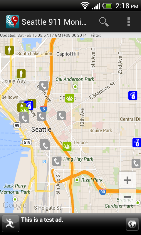
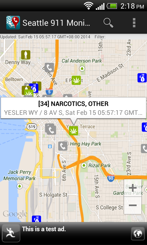
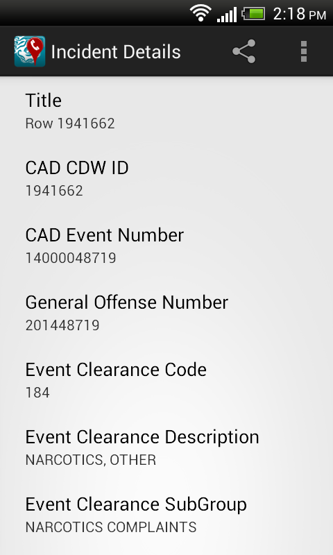
To view all the incidents on a map, simply select the Map option item in the Action Bar menu. The filter (if any) remains in effect util it is cleared. Touching any incident icon will pop up a snippet of information about the incident. Touching the snippet will display the incident details.


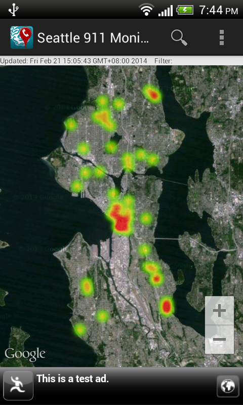
Instead of visualizing the incidents as marker icons, choosing the Heat map option item in the Action Bar menu will render the incidents as a heat map, as shown below. To display as marker icons again, just choose the Markers option item in the Action Bar menu.


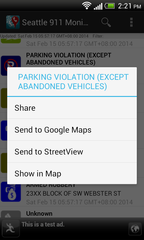
Long pressing any item in the incident list will pop up a menu, as shown below, where the selected incident can be shared, located on a map, or sent to the Google Maps or Street View app.


To refresh the call incidents or select a different incident feed, touch the Refresh option item in the Action Bar menu.
 
The app can be downloaded from Google Play.
Get it on Google Play

Monday, December 23, 2013

Seattle 911 incidents monitoring WebApp

This WebApp allows users to monitor the City of Seattle's Fire Department's real time 911 dispatches (updated every five minutes) and the Seattle Police Department's 911 dispatch incident responses that are non-confidential (updated every 4 hours) on a Google Maps backdrop. Simply choose the appropriate feed on the 911 feed drop down menu on the right pane.

The 911 incidents are shown as clickable icons with tool tips on Google Maps. Clicking on an icon will bring up more details about the incident. Users can utilize additional built-in Google Maps features such as Street View, or 3-D oblique 45 degrees views to immerse themselves into the incident environment.

The 911 incidents are also shown as a list on the right pane. The list can be sorted by incident category, date-time and address - either in ascending or descending order. Clicking the Maps hyperlink will automatically locate, zoom, and center the incident in the Map view.

The WebApp can be launched from this link http://dominoc925-pages.appspot.com/webapp/seattle911mon/default.html