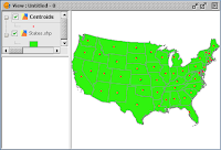
 It is possible to use gvSIG to create polygon centroids but this is done indirectly through the use of add-on functionality from the Sextante tool box. Note that the centroid created will be at the geometric center of the polygon, which may lie outside depending on the shape of the polygon. An illustration of how to create the centroids is shown below.
- Start gvSIG OADE. Load a polygon layer e.g. States.shp into a map View.

- Click the SEXTANTE Toolbox icon
 in the tool bar.
The SEXTANTE window appears.
- Expand the Algorithms | Tools for polygon layers nodes.

- Double click Centroids.
The Centroids dialog box appears.
- In the Vector layer field, choose the polygon layer e.g. States.shp.
- Optional. In the Outputs Centroids field, type in the full path and name of the centroids shape file.
- Click OK.
The centroids are created.

No comments:
Post a Comment