The
forest canopy height is the height of the highest vegetation above the ground level. It is possible to calculate the canopy height from LiDAR derived
digital terrain models (DTM) and
digital surface models (DSM) gridded datasets by doing a simple subtraction in
Global Mapper. The example below shows how to use the
Combine Terrain Layers function in Global Mapper to calculate the canopy height.
- Start up Global Mapper. Load in a digital terrain model ESRI ArcGrid file e.g. dtm.asc.

- Load in a digital surface model ESRI ArcGrid file e.g. dsm.asc.

- Select File | Combine Terrain Layers.
The Combine Terrain Options dialog box appears.
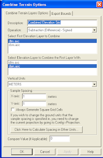
- In the Description field, type in relevant text e.g. CanopyHeight.
- In the Operation field, choose Subtraction (Difference) - Signed.
- In the Select First Elevation Layer to Combine field, choose the DSM layer e.g. dsm.asc.
- In the Select Elevation Layer to Combine the First Layer With field, choose the DTM layer e.g. dtm.asc.

- Click OK.
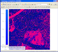
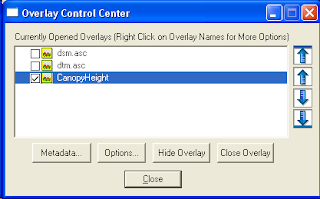
- Press CTRL+C. Toggle off the DTM and DSM layers.
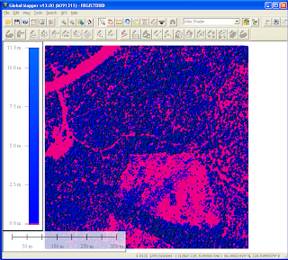
The canopy height is displayed as shown below where the pink indicates zero canopy heights and the blues are positive heights.

 The forest canopy height is the height of the highest vegetation above the ground level. It is possible to calculate the canopy height from LiDAR derived digital terrain models (DTM) and digital surface models (DSM) gridded datasets by doing a simple subtraction in Global Mapper. The example below shows how to use the Combine Terrain Layers function in Global Mapper to calculate the canopy height.


No comments:
Post a Comment