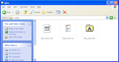
GeoMedia Grid 6.1.1 has one additional tool to work with LiDAR LAS files - the LiDAR Files to Text Files utility. As the name indicates, this utility will convert one or more LAS files into ASCII text files. If you find that converting LAS files to GeoMedia feature classes take too long and you have a lot of disk space, then you could use this utility to convert first to text files before creating native GeoMedia Grid *.mfm files. Besides creating the text files, this utility will also create the GeoMedia text server file definition file (*.tfd) for convenience. With this *.tfd file, you simply use the GeoMedia Warehouse Connection Wizard to connect to the LiDAR text files.
Here are the steps to use the LiDAR Files to Text Files Utility.
- From the Windows Desktop, select Start | All Programs | GeoMedia Grid | Utilities | LiDAR Files to Text Files.
The LiDAR Files to Text File dialog box appears.
- Click Add. And choose a LiDAR LAS file.
The selected LAS file is added to the Input LiDAR files list.
- In the Output text file name field, click Browse.
The Save As dialog box appears.
- In the File name field, type in an output name. Click Save.
The Apply button becomes enabled. - Click Apply.
The LAS file is converted into a text file and the LiDAR Files to Text File Log Summary is displayed.
- Click Close.

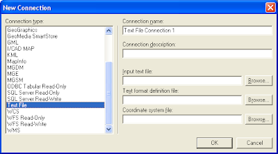
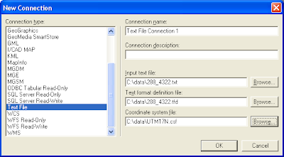
This *.tfd file can be used when you make a connection to the newly created text file with the Warehouse | New Connection command in GeoMedia as shown below.

After filling in the input text file, text format definition file and the coordinate system file, the New Connection dialog box should like the figure below.

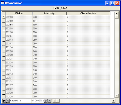
Once connected, the contents of the text file can be displayed in GeoMedia's Data Window.


No comments:
Post a Comment