Showing posts with label QGIS. Show all posts

Monday, May 27, 2024

QGIS - Finding location by coordinates

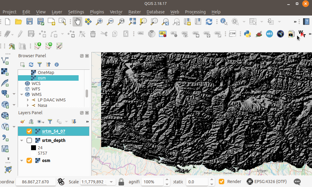
If you need to find specific locations by entering coordinates directly on a map, QGIS offers a handy tool for this purpose. I stumbled upon this feature by chance, and it’s incredibly useful. On the status bar at the bottom of the QGIS interface, there is a field where you can input the desired map coordinates. Here’s how you can use it:

  1. Open QGIS: Start by launching the QGIS application.


  2. Click on the Status Bar Field: Locate the status bar at the bottom left of the screen and click on the input field. A dialog box will pop up.


  3. Enter Coordinates:  Enter the coordinates you want to locate, for example, 3.0584N, 101.566E.


  4. Press ENTER: After typing in the coordinates, hit the ENTER key.

A red circle will blink a few times on the map, indicating the location you specified. This simple yet powerful tool makes it easy to pinpoint exact locations on your map with just a few clicks.


Monday, October 24, 2022

QGIS unable to edit SpatiaLite database layer workaround

Recently I upgraded to QGIS 3.26 on Ubuntu 22.04 and found that I was unable to edit my existing SpatiaLite database layers, i.e. the Toggle Editing tool bar icon could not be enabled. The screenshot below illustrates the problem.

While I have not found the cause of the problem, I found a simple workaround to the issue: just create a new SpatiaLite database and import the layers from the old database. The newly imported database layers can be enabled for editing. 


Create a new SpatiaLite database

  1. In the Browser pane of QGIS, press the right mouse button on the SpatiaLite node.


    A pop up menu appear.

  2. Choose Create New Database.


  3. In the Name field, type in a new SpatiaLite database file name, e.g. new_rail.sqlite. Click Save.

    The database is created.


Import layers from the old SpatiaLite database to the new SpatiaLite database

  1. If the layer e.g. node from the old SpatiaLite database e.g. rail.sqlite is not displayed in QGIS, then add the layer to the map window.


  2. In the QGIS menu, select Database | DB Manager.

    The DB Manager dialog box appears.


  3. Expand the SpatiaLite Providers tree node and double click on the newly created SpatiaLite database, e.g. new_rail.sqlite.


  4. Click Import Layer/File.

    The Import vector layer dialog box appears.


  5. In the Input drop down list, choose the layer from the old database, e.g. nodes. In the Output Table field, type in a new table name, e.g. nodes. Click OK.

    The old layer is imported into the new database.

Displaying the newly imported Spatialite layer

  1. In QGIS, select Layer | Add Layer | Add SpatiaLite Layer.


  2. In the Connections drop down list, select the new SpatiaLite database, e.g. new_rail.sqlite. Click Connect.

  3. In the table list, select the new layer nodes. Click Add.

    The new nodes layer is displayed in the map window.


  4. Select the new layer nodes in the Legend pane.

    The Toggle Editing icon is enabled now.


Monday, May 16, 2022

Convert Geoids from BYN to GTX format with this WebApp

This WebApp came about because I wanted to use some Geoid files for some vertical datum corrections with Proj (which uses .gtx format) but could only find Geoid files in Natural Resources Canada's .byn format.

  1. To convert Geoid BYN files to GTX, open up a browser to the following url: https://dominoc925-pages.appspot.com/webapp/byn2gtx/index.html.


    The WebApp is loaded.


  2. Click the Add File button.

    The File Upload dialog appears.


  3. Browse and select a .byn file e.g. EGM96.byn. Click Open.


    The Geoid file is displayed in a list and the Convert button is enabled.
    Note: the Geoid .byn is loaded locally to the browser and not transferred to some server on the Internet.


  4. Click the Convert button.

    The Geoid file is converted into .gtx format and the Process log and Save As icons are enabled.


  5. Optional. To view the process log, click the Show Process Log icon.

    The process log messages are displayed.


  6. To save the converted .gtx Geoid locally, click the Save Converted File icon.

    The Geoid file is saved.


  7. Optional. If necessary, you can use a GIS software like QGIS to display the converted .gtx file, as shown below.


Monday, March 29, 2021

Installing the long term release version of QGIS using Flatpak on Ubuntu

The flatpak command on Ubuntu is used to install packaged software such as QGIS from a remote flathub repository. Normally, the following Terminal command to install QGIS is as follows:

$ flatpak install qgis


By default, this will install the stable branch of QGIS. In the screen shot below, it is version 3.18, but this may not be the version you want. Perhaps you wanted to use the long term release version, which is under a different lts branch. 


To get flatpak to install the lts branch of QGIS, type in the following command in the Terminal.

$ flatpak install org.qgis.qgis//lts

And follow the prompts to complete the installation.


Finally, as a check, open up QGIS and display the version.


Monday, January 11, 2021

QGIS - Change the background color of multiple raster images to transparent

QGIS can easily display geo-referenced raster images; by default the background pixels or no data value pixels are colored as black, as shown in the screenshot below. 


The black no data colored pixels can obscure other vector or raster data underneath it. You can use QGIS to define a color to be rendered as transparent in the raster layer's properties. This can be easily done for a single raster layer. If you want to do it for multiple raster layers at once, then you have to copy the style of the raster layer with a transparent color set and apply that style to the rest of the raster layers.

This post illustrates the steps.

Define the transparent color for a single raster layer

  1. Start up QGIS. Load and display the raster images.

    The raster layers are displayed with black as the background color.


  2. In the Layers pane, mouse right click on a raster layer. Choose Properties. Select Transparency.

    The Properties dialog box is displayed.


  3. In the Transparency pixel list, click the + icon.

    An RGB entry is added to the list.

  4. In the Red, Green, and Blue fields, enter 0.


  5. Click OK.

    The selected raster layer's background pixels are rendered transparent.


  6. In the Layers pane, mouse right click on the raster layer with transparent background and choose Styles | Copy Style.


  7. In the Layers pane again, press CTRL or SHIFT and select one or more raster layers.

    Multiple raster layers are selected.

  8. In the Layers pane, mouse right click on a selected raster layer and choose Paste Style.

    The selected raster layers' background is rendered transparent.

Monday, October 7, 2019

Add Mars Web Mapping Tile Server datasets from NASA to QGIS

NASA publishes Mars dataset such as the Viking Color Mosaic or the Mars Orbiter Laser Altimeter Color Hillshade  for public access at this web site https://api.nasa.gov/api.html. The dataset are published as OGC RESTful Web Mapping and Tile Services - hence they can be pulled down and displayed in QGIS.

For convenience, the full list of the dataset extracted from the service is shown below:
Layer Url
Viking Color Mosaic - Global Map https://api.nasa.gov/mars-wmts/catalog/Mars_Viking_MDIM21_ClrMosaic_global_232m/1.0.0//default/default028mm/{z}/{y}/{x}.jpg
CTX Mosaic - Curiosity Landing Site https://api.nasa.gov/mars-wmts/catalog/curiosity_ctx_mosaic/1.0.0//default/default028mm/{z}/{y}/{x}.png
HiRISE Mosaic - Curiosity Landing Site https://api.nasa.gov/mars-wmts/catalog/curiosity_hirise_mosaic/1.0.0//default/default028mm/{z}/{y}/{x}.png
HiRISE Mosaic - ESP_040776_2115 https://api.nasa.gov/mars-wmts/catalog/ESP_040776_2115_RED_A_01_ORTHO/1.0.0//default/default028mm/{z}/{y}/{x}.png
HiRISE Mosaic - ESP_042252_1930_RED_B_01_ORTHO https://api.nasa.gov/mars-wmts/catalog/ESP_042252_1930_RED_B_01_ORTHO/1.0.0//default/default028mm/{z}/{y}/{x}.png
HiRISE Mosaic - ESP_042647_1760_RED_B_01_ORTHO https://api.nasa.gov/mars-wmts/catalog/ESP_042647_1760_RED_B_01_ORTHO/1.0.0//default/default028mm/{z}/{y}/{x}.png
HRSC Mosaic - Martian East https://api.nasa.gov/mars-wmts/catalog/HRSC_Martian_east/1.0.0//default/default028mm/{z}/{y}/{x}.png
HRSC Color Mosaic - MC11 https://api.nasa.gov/mars-wmts/catalog/MC11E_HRMOSCO_COL/1.0.0//default/default028mm/{z}/{y}/{x}.png
HRSC Mosaic - MC11 https://api.nasa.gov/mars-wmts/catalog/MC11E_HRMOSND_ND5/1.0.0//default/default028mm/{z}/{y}/{x}.png
HiRISE Mosaic - Spirit Landing Site https://api.nasa.gov/mars-wmts/catalog/spirit_hirise_mosaic/1.0.0//default/default028mm/{z}/{y}/{x}.png
HiRISE Mosaic - Opportunity Landing Site https://api.nasa.gov/mars-wmts/catalog/opportunity_hirise_mosaic/1.0.0//default/default028mm/{z}/{y}/{x}.png
HiRISE Mosaic - Phoenix Landing Site https://api.nasa.gov/mars-wmts/catalog/phoenix_hirise_mosaic/1.0.0//default/default028mm/{z}/{y}/{x}.png
HiRISE Mosaic - Sojourner Landing Site https://api.nasa.gov/mars-wmts/catalog/sojourner_hirise_mosaic/1.0.0//default/default028mm/{z}/{y}/{x}.png
Albedo Mosaic - Thermal Emission Spectrometer https://api.nasa.gov/mars-wmts/catalog/Mars_MGS_TES_Albedo_mosaic_global_7410m/1.0.0//default/default028mm/{z}/{y}/{x}.png
DEM Grayscale - Mars Orbiter Laser Altimeter https://api.nasa.gov/mars-wmts/catalog/Mars_MGS_MOLA_DEM_mosaic_global_463m_8/1.0.0//default/default028mm/{z}/{y}/{x}.png
Color Hillshade - Mars Orbiter Laser Altimeter https://api.nasa.gov/mars-wmts/catalog/Mars_MGS_MOLA_ClrShade_merge_global_463m/1.0.0//default/default028mm/{z}/{y}/{x}.jpg
Experience Curiosity - Curiosity Landing Site https://api.nasa.gov/mars-wmts/catalog/mars_pahrump_patch_8k_256m/1.0.0//default/default028mm/{z}/{y}/{x}.png
Atlas Mosaic - Mars Orbiter Camera https://api.nasa.gov/mars-wmts/catalog/msss_atlas_simp_clon/1.0.0//default/default028mm/{z}/{y}/{x}.png
Infrared Night - Thermal Emission Imaging System https://api.nasa.gov/mars-wmts/catalog/Mars_MO_THEMIS-IR-Night_mosaic_60N60S_100m_v14_clon0_ly/1.0.0//default/default028mm/{z}/{y}/{x}.jpg
Infrared Day - Thermal Emission Imaging System https://api.nasa.gov/mars-wmts/catalog/Mars_MO_THEMIS-IR-Day_mosaic_global_100m_v12_clon0_ly/1.0.0//default/default028mm/{z}/{y}/{x}.jpg
HRSC Mosaic - Mawrth Vallis https://api.nasa.gov/mars-wmts/catalog/hrsc_mawrth_vallis/1.0.0//default/default028mm/{z}/{y}/{x}.png
HRSC Color Mosaic - Mawrth Vallis https://api.nasa.gov/mars-wmts/catalog/hrsc_mawrth_vallis_color/1.0.0//default/default028mm/{z}/{y}/{x}.png

To add a MARS dataset to QGIS, do the following:
  1. Start QGIS. In the Browser panel, mouse right click on the Tile Server (XYZ). Select New Connection.


  2.  In the New XYZ tile layer, type in the URL for the chosen dataset, e.g. https://api.nasa.gov/mars-wmts/catalog/Mars_MGS_MOLA_ClrShade_merge_global_463m/1.0.0//default/default028mm/{z}/{y}/{x}.jpg

  3. Click OK.
  4. Type in the name of the tile layer, e.g. Color Hillshade - Mars Orbiter Laser Altimeter.

  5. Click OK.

    The tile layer connection is added to the Tile Server (XYZ) node.
  6. Mouse right click on the newly added tile server node. Choose Add layer.

    The selected layer is displayed in QGIS.

Monday, April 29, 2019

Create a Facebook 3D Photo of a digital elevation model using QGIS

Facebook has a 3D photo feature which brings perspective and movement to the Facebook news feed and timeline images. A live example can be seen embedded here:


Normally these images are created using RGB-D cameras, where D stands for depth. However it is also possible to workaround it without a RGB-D camera by uploading to Facebook two images - an RGB image and its corresponding grayscale depth image, and making sure the depth image has the same name as the RGB image with a '_depth' suffix. The depth image is grayscale only with values ranging from dark to light -  the dark pixels representing the furthest pixels and the light pixels representing the nearest pixels.

Using the ideas above, the following steps illustrate how to create a Facebook 3D Photo image from a SRTM digital elevation model (DEM) using QGIS.

  1. Startup QGIS. Create a new project. If the canvas background is not already black, select Project | Project Properties.

    The Project Properties dialog box appears.
  2. In the Background color field, change the color to black. Click OK.

    The canvas background becomes black.
  3. Drag and drop a DEM file onto the canvas e.g. srtm_54_07.tif.

     
  4.  Optional. To serve the purpose of having a background, an OpenStreetMap (OSM) layer is displayed behind the DEM layer.

  5. Optional. To display only DEM heights above an elevation of interest, e.g. 200 meters, right click on the DEM layer and choose Properties. Then add in a new transparent entry to the transparent pixel list from 0 to 200 meters, as shown below. Then click OK.

    The Layer Properties dialog box appears.


    The DEM display is updated.

  6. Make a duplicate of the DEM layer by right clicking on the DEM layer and choosing Duplicate. Rename the copy as 'depth' as it will serve to generate a depth image later on.

  7. Right click on the top most DEM layer and choose Properties. In the Layer properties dialog box, click Style.

  8. Change the Render Type to Hillshade. Click OK.

    The DEM layer is now rendered as a hill shade.
  9. Make a duplicate copy of the hill shaded DEM layer by right clicking the layer and choosing Duplicate. Rename the copy as 'hillshade' as shown below.

  10. Right click on the top most DEM layer and choose Properties. Select the Style tab.

  11. In the Rendering type field, choose Singleband pseudocolor. Choose a suitable color gradient e.g. Spectral and toggle Invert if necessary. Choose a suitable Blending mode e.g. Screen.

  12. Click OK.

    The DEM layer is rendered with a colored gradient.
  13. With the gradient colored, hill shaded and OSM layers displayed on and the depth layer displayed off, export out the canvas by selecting Project | Save as image and specifying an output file name e.g. srtm.png.

    The srtm image is generated.
  14. Now turn off the gradient, hill shaded and OSM layers. Turn on the depth layer as shown below.


    Select Project | Save as image to export out the depth image with a '_depth' suffix e.g. srtm_depth.png.

    The srtm_depth image is generated.
  15. Now open up Facebook in a browser and click the Post Photo/Video button.

    The File Upload dialog box appears.
  16. Browse and select the generated srtm.png and srtm_depth.png files. Click Open.

    Facebook generates the 3D Photo.


    A live example is available here at https://www.facebook.com/permalink.php?story_fbid=1251984134967474&id=101193703379862