Showing posts with label WKT. Show all posts

Monday, February 12, 2018

Displaying WKT geometry string in QGIS with getWKT plugin

If you want to display the Well Known Text (WKT) string of a selected geometry in QGIS, there is a plug-in getWKT that can be used for this purpose. The screen shot below shows the Plug-in Manager's description of the getWKT plug-in.
 
 To use the getWKT plug-in, do the following:
  1. In QGIS, click the Select Features by area of single click button. Using the mouse, click on a feature.

    A feature is selected and highlighted in yellow.
  2. Then click the getWKT icon in the tool bar.


    The GetWKT dialog box appears with the WKT string of the selected geometry.

Monday, January 29, 2018

Display CSV (with WKT geometry field) files on Google Maps with this Mapplet

If you want to display a Comma Separated Values (CSV) file with an embedded geometry field in Well Known Text (WKT) format with just an Internet browser, then this Mapplet may be useful to you. Just go to this url https://dominoc925-pages.appspot.com/mapplets/vcsvfile.html with any modern browser such as Chrome, or FireFox. All the processing is done within your browser, that is the CSV file is never uploaded to a server for processing.


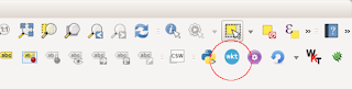
  1. To load a CSV file, click on the Import CSV button (in blue color) as shown in the screenshot below. 


    The Import Comma Separated Values (CSV) file dialog box appears.

  2. To load in a CSV file from a local drive, click the Choose File button. Then browse and select a CSV file as shown below.


    Note: You can also copy and paste WKT text into the CSV file field's text area. Or click the Use Sample Data drop up button to load demo WKT data into the text area.

  3. Click Open.

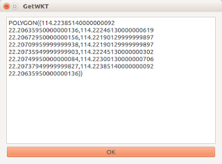
    The file is read and displayed in the text area below the Choose File button. The WKT Geometry column button is populated with the header fields from the CSV file.


    Note: If necessary, choose an appropriate Coordinate System and projection.
  4. Click Start Import.

    The CSV file is loaded and rendered as overlays on the Google Maps backdrop. The name of the file is added to a CSV files combo box.

  5. Optional. Click on the CSV Command drop up button and choose a command to apply to the current CSV layer.


    Fit - Display the current CSV layer within the map
    Fit All - Display all loaded CSV layers within the map
    Toggle display - Toggle the CSV layer display on or off
    Display off - Don't display the current CSV layer
    Display on - Display the current CSV layer
    Remove layer - Unload the current CSV layer

Monday, January 22, 2018

Using QGIS to export CSV files with Well Known Text geometry

QGIS can export feature layers as comma separated values (*.CSV) files with a geometry column in  Well Known Text (WKT) format. This can be very convenient if you want to exchange a small amount of data from one GIS system to another GIS system.

To save a vector feature layer to a WKT CSV file, do the following:

  1. In the legend pane of QGIS, select a layer to export, e.g. forest. Then press the right click of the mouse.

    A pop up menu appears.

  2. In the pop up menu, choose Save As.
  3. The Save vector layer as dialog box appears.


  4. In the Format combo box, choose Comma Separated Values (CSV). In the File name field, click the  Browse button and type in the output file name, e.g. forest.csv.


  5. In the Layer Options group box's GEOMETRY combo box, choose AS_WKT. Click OK.

    The selected vector layer is exported out as a CSV file with a geometry field as WKT format as shown below in a spread sheet.